


Test 4 — December 9, 2026
Wednesday, December 9, 2026 — Chapters 9, 10 and 11. The exam takes place during your scheduled class time. If you have questions, email Professor Hoffman.
Chapter 10 Class Videos
Thunderstorms — Part 1
Tornadoes — Part 2
How Thunderstorms Form
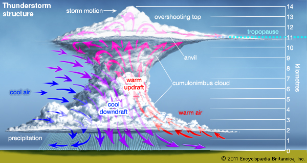
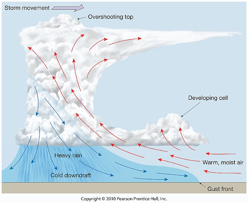
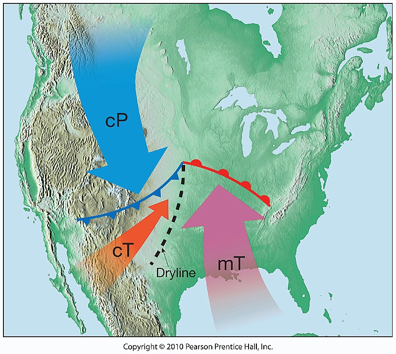
A thunderstorm produces lightning and thunder. Warm, moist air rises in an unstable atmosphere, cools, and forms a cumulonimbus cloud. Uneven daytime heating, sea-breeze convergence, mountains, and frontal lifting can trigger storms. Many thunderstorms form in maritime tropical (mT) air, especially ahead of cold fronts.
Air-mass thunderstorms
Often scattered, short-lived summertime storms that develop away from fronts in warm, humid air.
Frontal thunderstorms
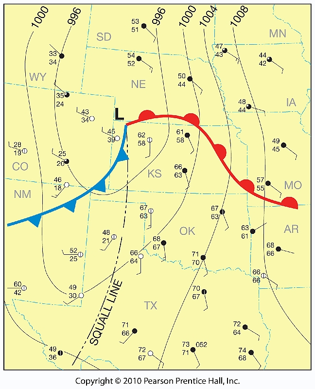
Frequently develop when a cold front lifts warm, moist air; storms may organize into lines.
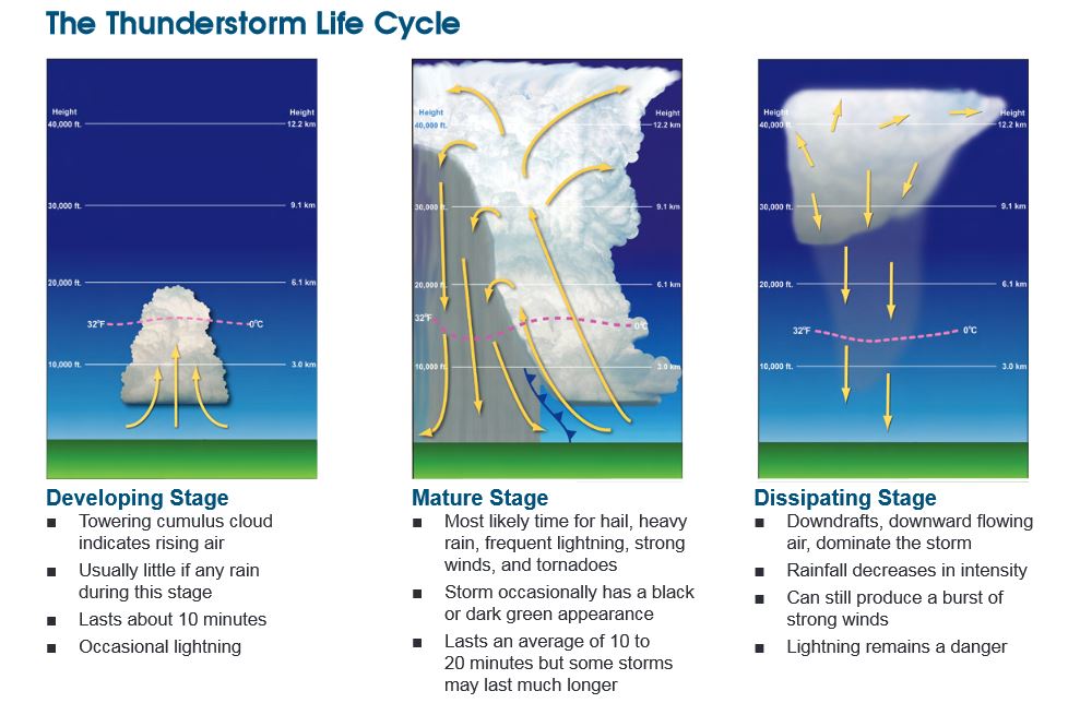
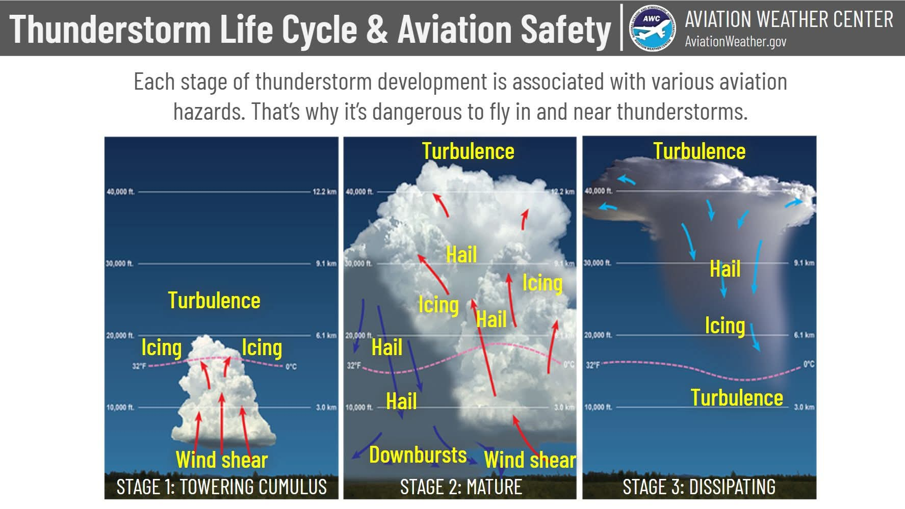
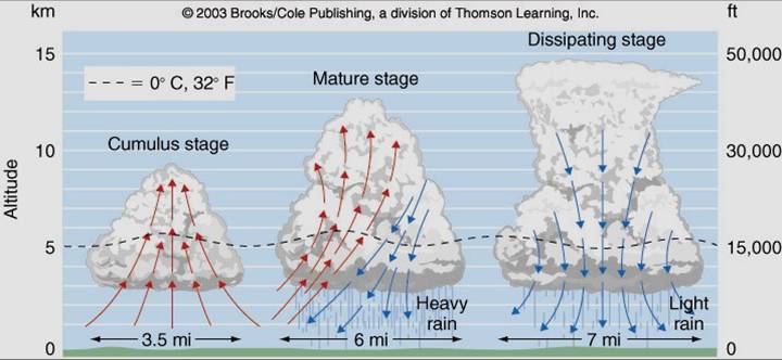
Three Stages of a Thunderstorm
1. Cumulus
Updrafts dominate as warm air rises and clouds grow. Little or no rain reaches the ground.
2. Mature
Updrafts and downdrafts coexist. Heavy rain, lightning, gusty winds and hail may occur.
3. Dissipating
Downdrafts dominate, cutting off the warm, moist updraft. Precipitation weakens.
Severe Thunderstorms and Hazards
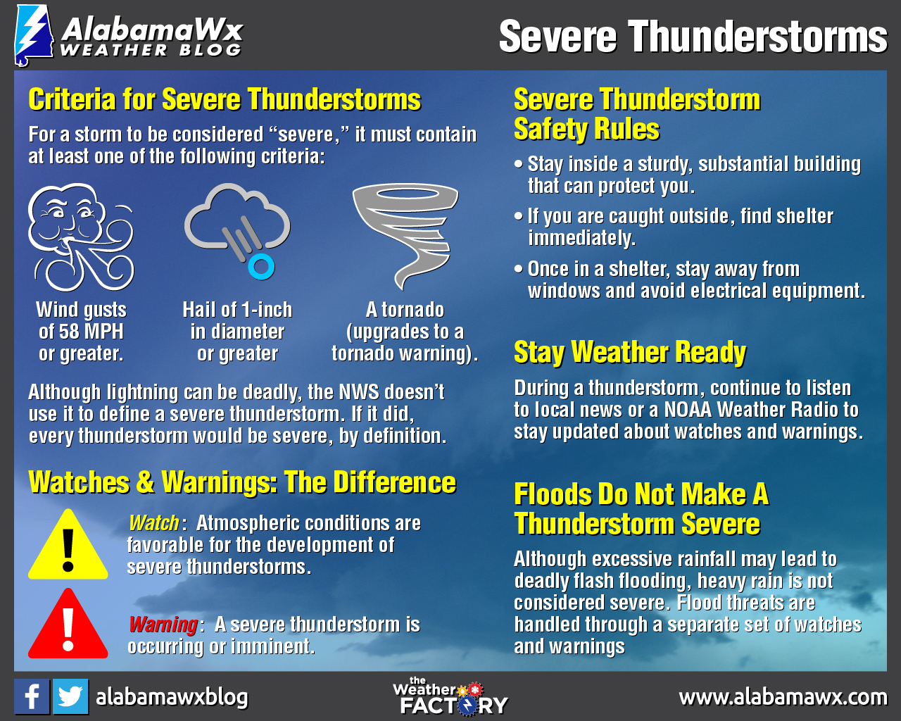
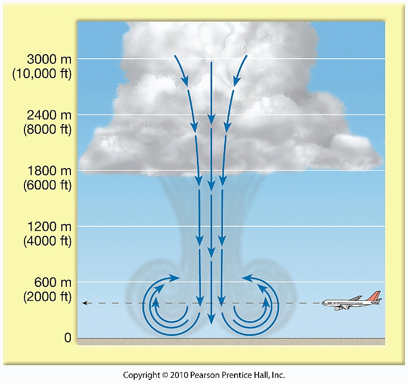
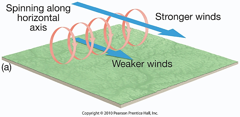
Severe storms can cause destructive straight-line winds, flash flooding, large hail, and tornadoes. Vertical wind shear helps organize and sustain stronger storms. A gust front forms when cool downdraft air spreads outward near the ground. A microburst is a concentrated, powerful downdraft that spreads out at the surface.
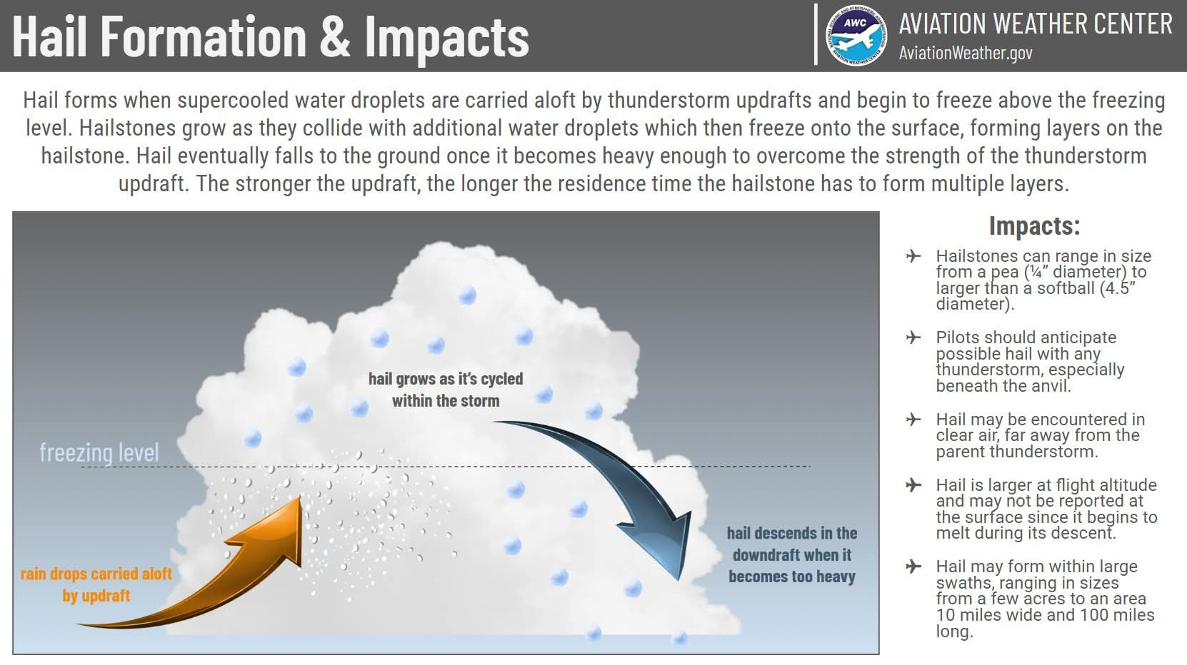
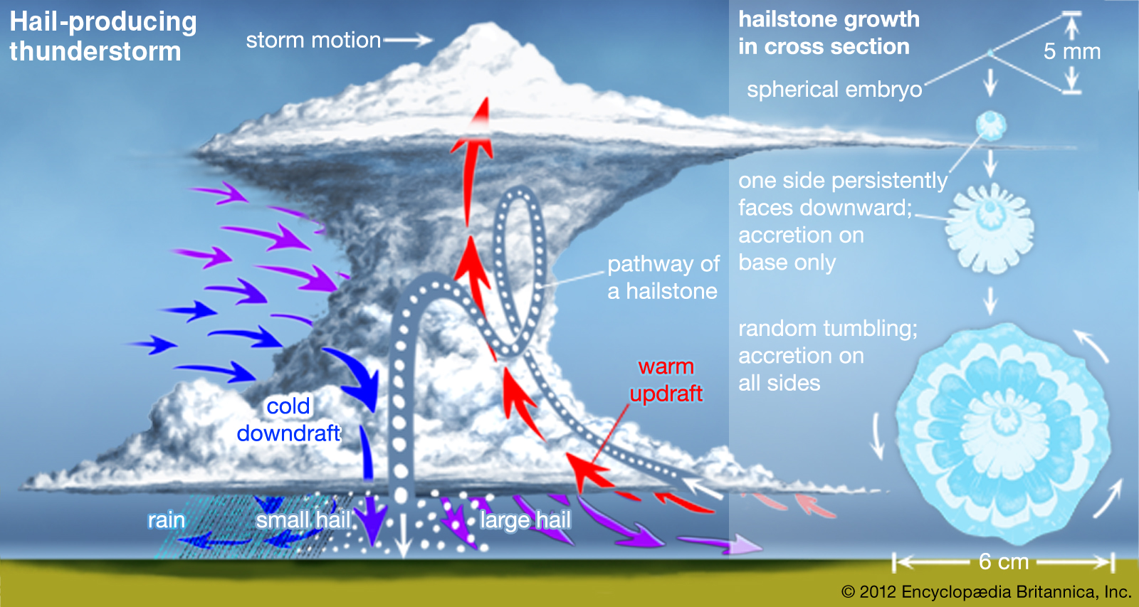
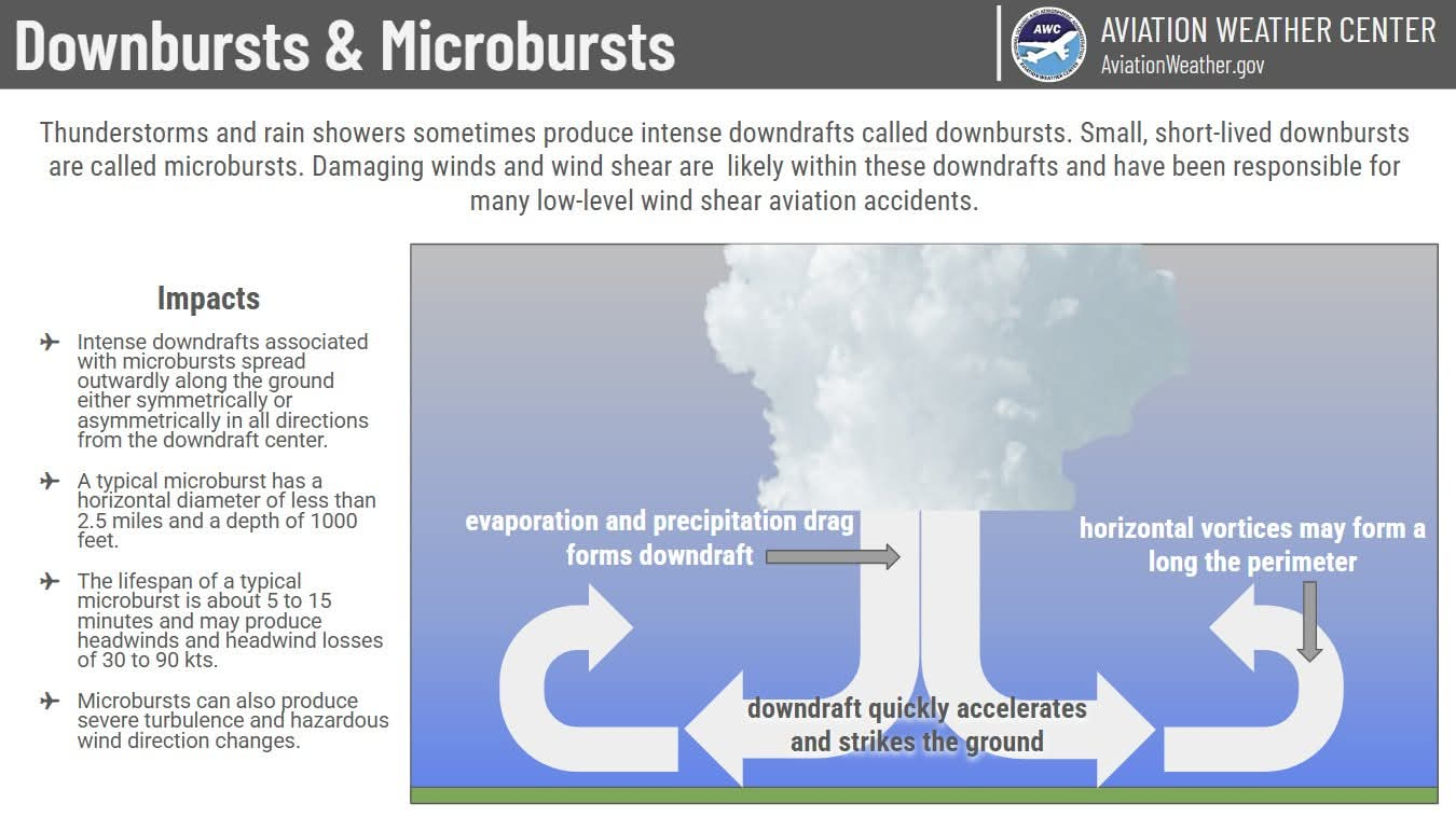
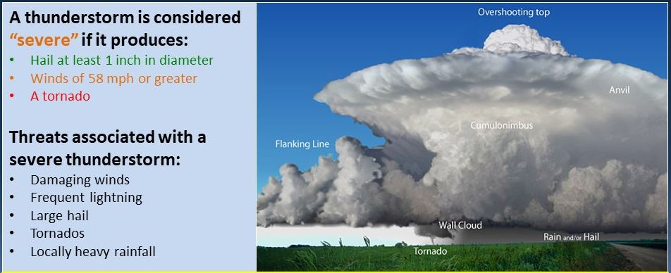
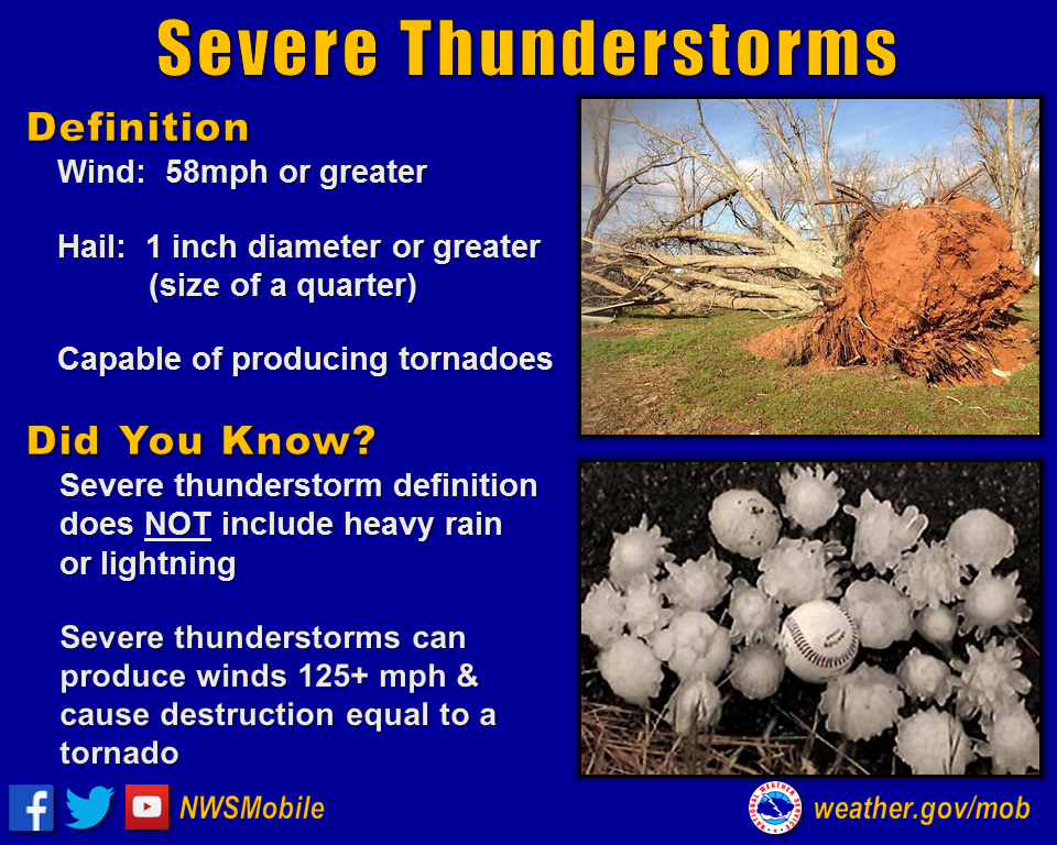
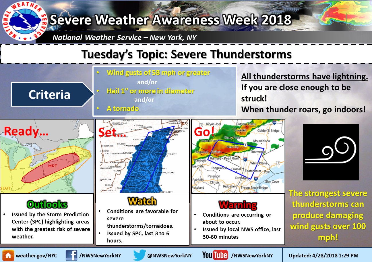
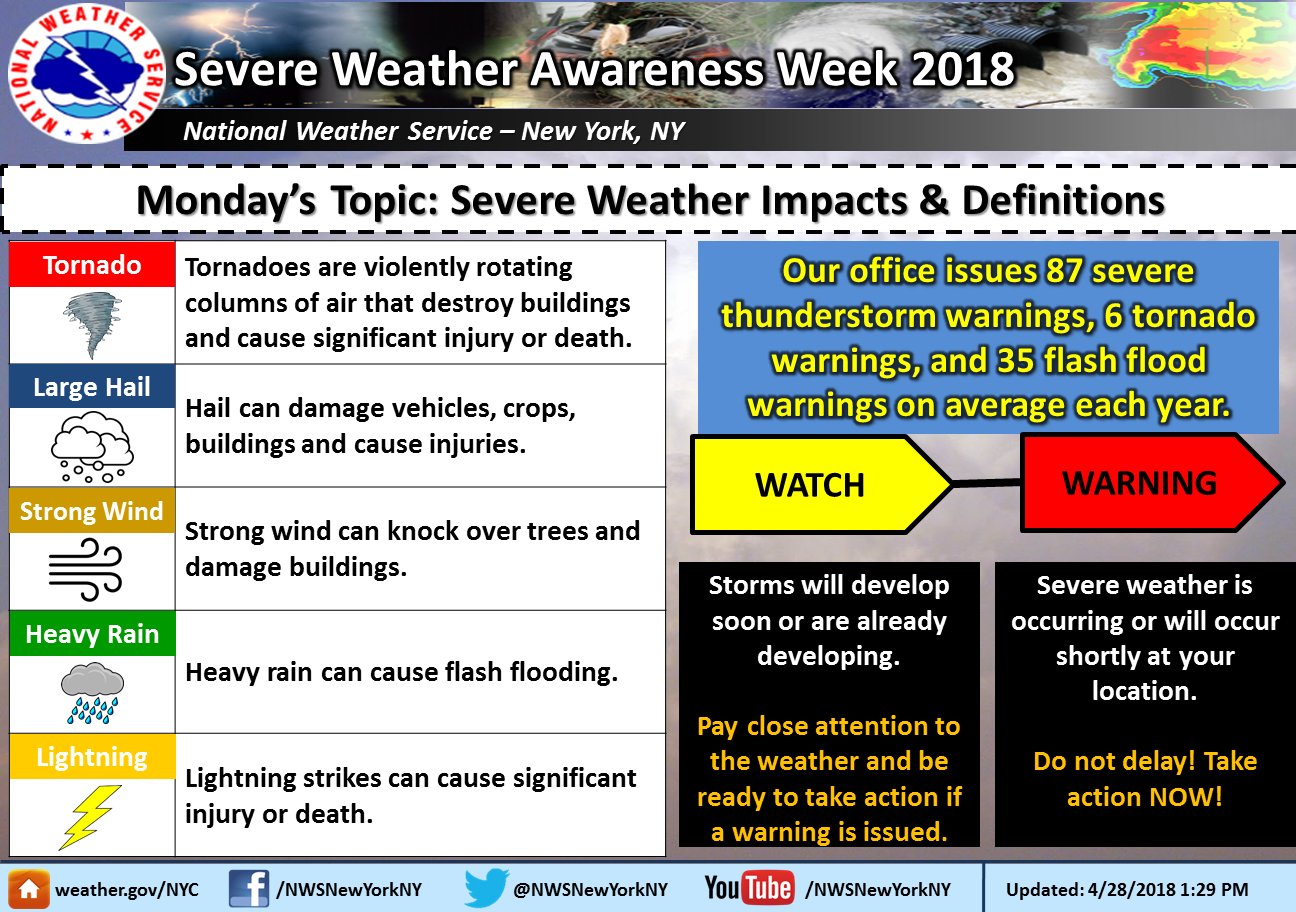
NWS New York / Long Island severe weather · Storm Prediction Center outlooks
Supercells, Squall Lines and MCCs
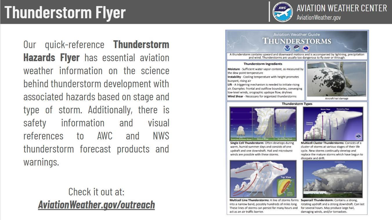
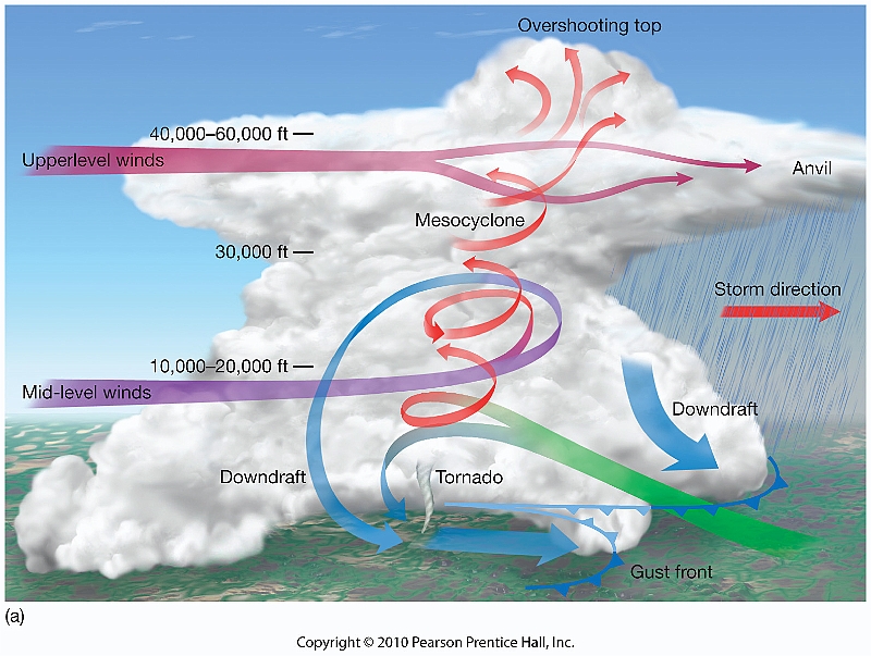
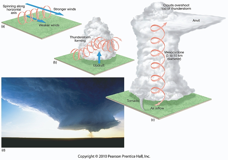
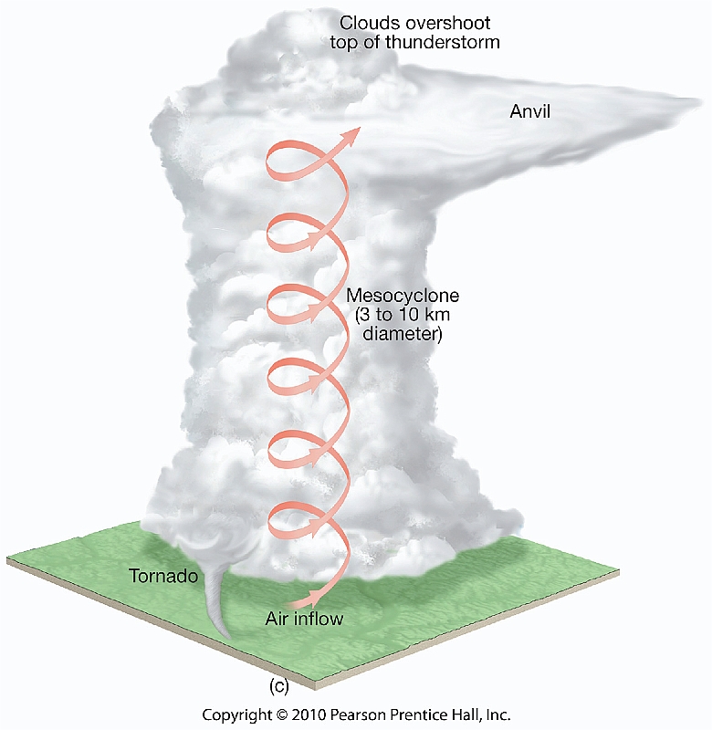
Supercells are long-lived thunderstorms with rotating updrafts called mesocyclones and can produce destructive hail, wind, and tornadoes. Squall lines are narrow bands of thunderstorms, often ahead of cold fronts or along drylines. Mesoscale convective complexes (MCCs) are large clusters of thunderstorms that can bring significant rainfall.
Lightning and Thunder
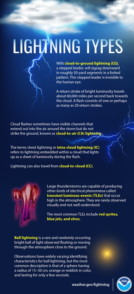
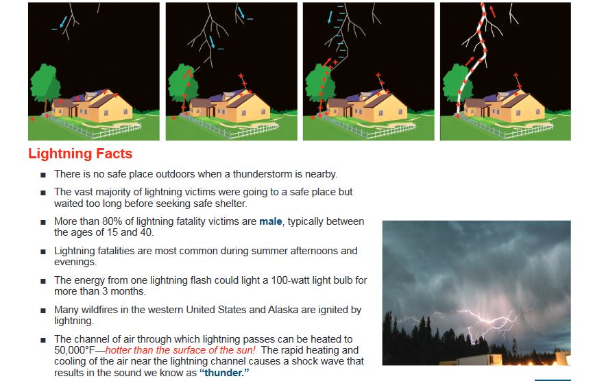
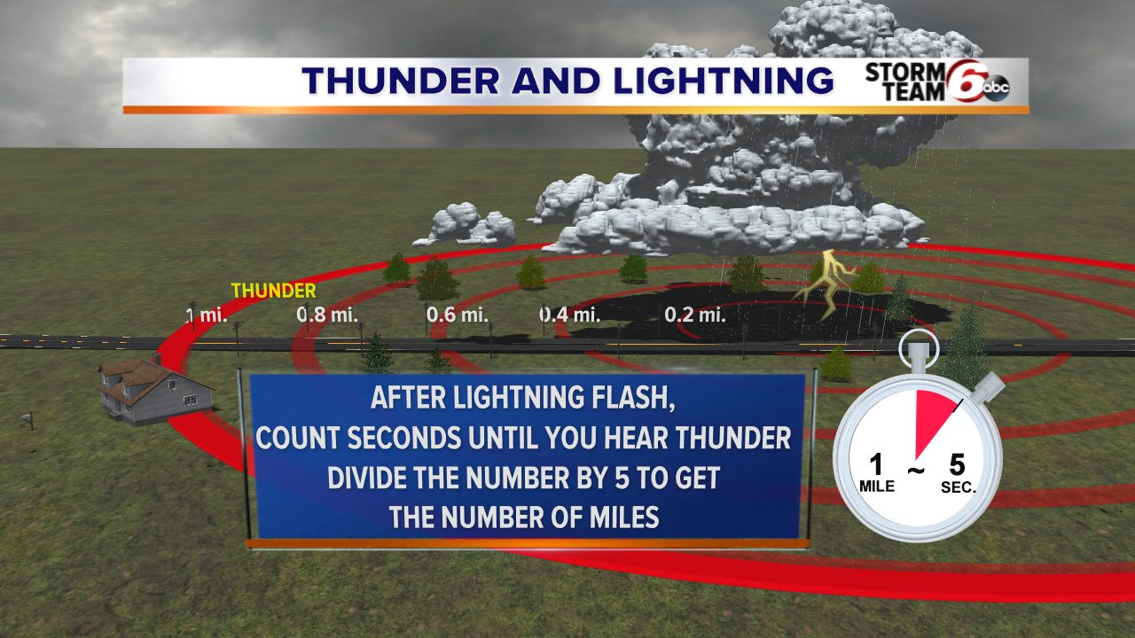
Lightning is an electrical discharge within clouds, between clouds, or between clouds and the ground. Lightning rapidly heats surrounding air, causing explosive expansion that creates thunder. Because light travels much faster than sound, you see the flash before hearing thunder.
Tornadoes and Tornado Formation
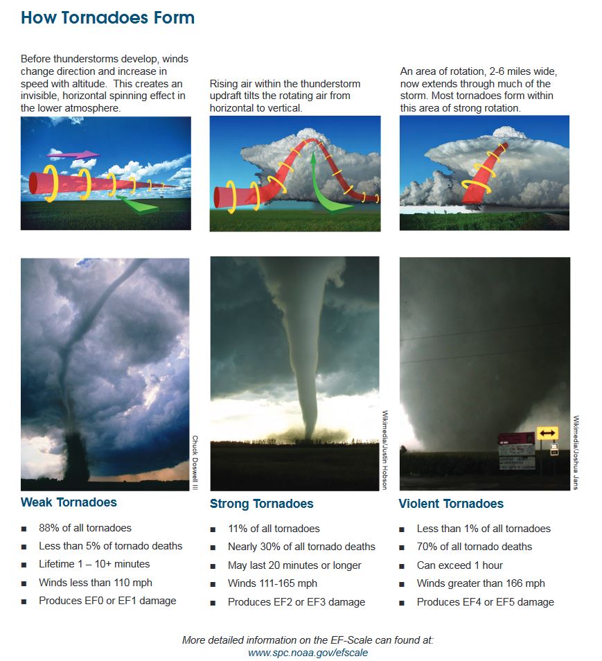
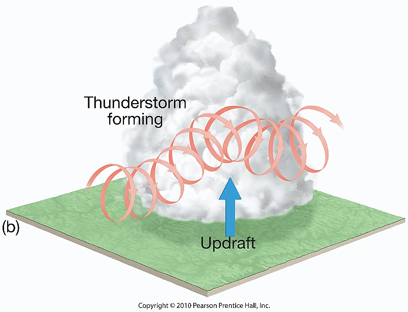
A tornado is a violently rotating column of air in contact with the ground and extending from a thunderstorm. Strong vertical wind shear and persistent rotating updrafts in supercells can lead to tornado development. Tornadoes can also occur with squall lines and tropical cyclones.
Study how a mesocyclone, wall cloud, and funnel cloud relate to tornado formation. A visible funnel is not required for a tornado to exist.
Enhanced Fujita (EF) Scale
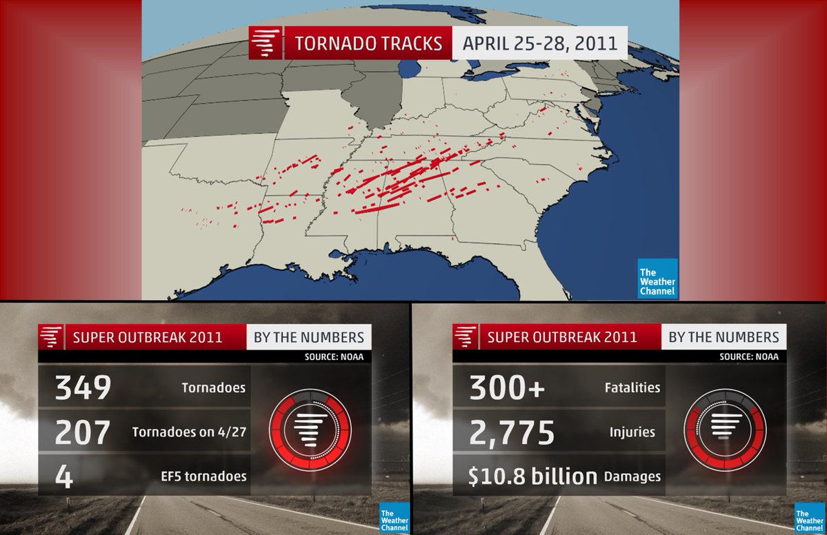
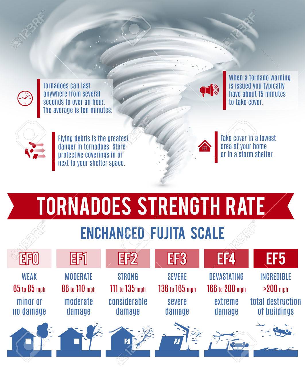
The EF scale estimates tornado wind speeds from observed damage and engineering-based damage indicators; it does not directly measure tornado winds. The Enhanced Fujita scale replaced the original Fujita scale in the United States in 2007.
| Rating | Estimated 3-second gust |
|---|---|
| EF0 | 65–85 mph |
| EF1 | 86–110 mph |
| EF2 | 111–135 mph |
| EF3 | 136–165 mph |
| EF4 | 166–200 mph |
| EF5 | Over 200 mph |
Long Island and Tri-State Tornado History
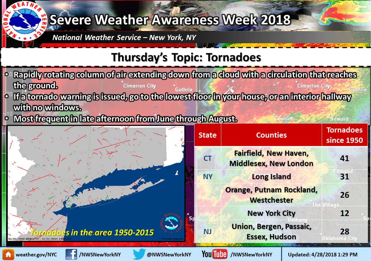
On November 13, 2021, the region experienced an unusual tornado outbreak, including six confirmed tornadoes on Long Island. Use the local National Weather Service case study to explore the storms and damage surveys.
Watches, Warnings and Weather Safety
Watch — Be prepared
Conditions are favorable for severe weather in or near the watch area.
Warning — Take action
Dangerous weather is occurring or imminent in the warned area.
The Storm Prediction Center issues severe weather outlooks and watches; local NWS offices issue warnings. Doppler radar helps meteorologists identify storm rotation and potentially dangerous winds.
Chapter 10 Materials and Weather Resources
Course presentations
What to Know for Test 4
- How and where thunderstorms form; atmospheric instability, lifting mechanisms and maritime tropical air.
- Where storms form around a midlatitude cyclone and its cold front.
- The cumulus, mature and dissipating stages of a thunderstorm.
- The definition of a severe thunderstorm and its main hazards.
- How wind shear, supercells and mesocyclones relate to tornado formation.
- How the Enhanced Fujita scale estimates tornado intensity.
- The difference between a severe weather watch and warning.
- How lightning produces thunder and how to stay safe.